


The digital basis of agricultural knowledge
The production site is the place where crops are grown, with characteristics that vary in space and time. It is a complex environment that provides the conditions for crop growth, which are determined by the land surface, climate, soil and physiological factors.
Successful farming requires an increasingly conscious adaptation to these factors, which is now unthinkable without digitalisation.
The importance of knowing where crops are grown becomes particularly important when, for whatever reason, we change our usual farming practices. Today, this can be forced by a number of external influences and changes: changes in the basic characteristics of the place where we grow our crops (climate, soil conditions, pest pressure), the emergence of new, efficient varieties that are not as demanding as the place where they are grown, or the need to diversify our crop portfolio due to the hectic nature of the supply market or environmental regulations, or the fact that we are on the verge of a major technological change.
Digitalisation is therefore both a constraint and an opportunity, a difficult learning process at the end of which we want the user to be able to reap the benefits of their efforts, even if only literally. With today’s capabilities, we can respond to the strengths and weaknesses of our territory, the expected production risks – due to natural influences – the needs of the selected crop varieties, the mapping of the corresponding management zones and the differentiated application plans.
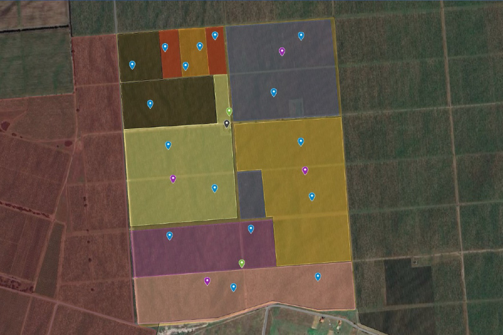
The key word is systems thinking – management zones with similar characteristics are not fixed formations, but the result of a spatial allocation that takes into account the needs of a particular crop. For other crops, we need to adapt our zones to their needs. In addition, some environmental factors change significantly in space and time and are modified by our agrotechnical interventions, so we need to detect and document changes and modifications.
Our IT solution needs to model this environmental and management complexity. This requires regular data collection, processing and analysis. Step by step, we need to build the system in such a way that the individual system elements (meteorological, soil and plant sensors, automatic traps, satellite or drone map data, data from implements, data from the field logbook recording our activities) can be integrated and mapped to each other in space and time.
Our IT solution needs to model this environmental and management complexity. This requires regular data collection, processing and analysis. Step by step, we need to build the system in such a way that the individual system elements (meteorological, soil and plant sensors, automatic traps, satellite or drone map data, data from implements, data from the field logbook recording our activities) can be integrated and mapped to each other in space and time.
In Hungary, 4iG’s vertical, industry-agnostic solutions cover the entire IT lifecycle, from infrastructure management to cyber security. Our platform- and vendor-independent full-service IT product and service portfolio is designed to meet the needs of typical multi-site organisations. As a 360-degree IT and telecom service provider, we can support all phases of the digitalisation of agriculture, from field data collection support to data distribution, processing, analysis and visualisation.
From an IT and communications point of view, we are responsible for data collection, data transfer, systematisation, validation, data integration, analysis and visualisation. From a management point of view: learning, adapting, striving for efficiency, precise management. Our objectives are common, as are our results.